


la folletière abenon

werth
User
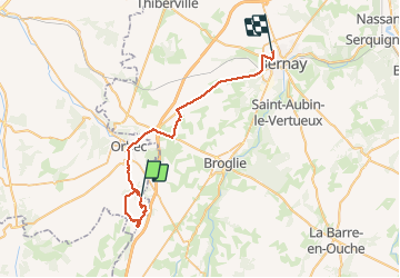

Length
36 km

Max alt
201 m

Uphill gradient
417 m
Km-Effort
42 km

Min alt
117 m

Downhill gradient
403 m
Boucle
No
Creation date :
2020-09-22 07:18:14.75
Updated on :
2020-09-22 11:45:11.616
4h25
Difficulty : Easy

FREE GPS app for hiking
 SityTrail
IGN / Geographical institutes
SityTrail Plus
The world is yours!
About
Trail Walking of 36 km to be discovered at Normandy, Calvados, La Folletière-Abenon. This trail is proposed by werth.
Description
très joli parcours
Positioning
Country:
France
Region :
Normandy
Department/Province :
Calvados
Municipality :
La Folletière-Abenon
Location:
Unknown
Start:(Dec)
Start:(UTM)
311566 ; 5428644 (31U) N.
Comments